Lake Washington Guide
Mercer Island Waterfront
By Colin Dalrymple
Written by Colin Dalrymple, Managing Broker, Windermere Real Estate.
Last updated . Figures checked against the source Northwest MLS export before publishing.
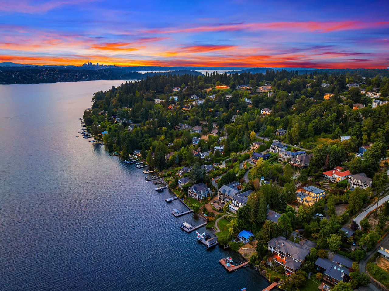
Mercer Island wraps an entire island in Lake Washington shoreline, which means orientation, moorage, and access vary enormously from one side of the island to another even at similar price points.
The city administers its own shoreline program, and the code chapter is published, so dock and bulkhead questions can be checked directly rather than assumed.
Closed Sales, August 2025 through July 2026
What Mercer Island waterfront actually sold for
Median sale price
$8,425,000
20 closed sales
Middle half of sales
$6.1M to $12.1M
25th to 75th percentile
Median per sq. ft.
$1,716
finished square footage
Median days on market
31
sold at 94.2% of original list
Full range across the period: $2,300,000 to $28,000,000. Frontage is what separates the bottom of that range from the top, how much of it, how it meets the water, what faces the afternoon sun, and whether the dock and shoreline are permitted as built.
Compiled by Colin Dalrymple from Northwest MLS sold records for detached waterfront homes closed in the period shown. Condominiums, townhomes and moorage-only sales are excluded. These are not official NWMLS statistics. Waterfront is thinly traded, so treat any market with fewer than ten sales as directional rather than definitive, and price a specific property off its own frontage, orientation and condition.
Confirmed with the City
What is on the record
Mercer Island's Shoreline Master Program is in Mercer Island City Code Chapter 19.13, administered by the city's Community Planning and Development department.
Source: Mercer Island Shoreline Management →
Anything not stated above is intentionally left out. Dock dimensions, bulkhead replacement rules, setbacks, and in-water work windows are decided per property and per project, so the right answer comes from the office below rather than from a summary.
Verify It Yourself
Who to call
City of Mercer Island, Community Planning and Development
Governing code: Mercer Island City Code Chapter 19.13
Applies Everywhere
State and federal layers
A state permit sits underneath every city permit
In-water and near-shore work in Washington needs a Hydraulic Project Approval from the Department of Fish and Wildlife, issued under RCW 77.55 and WAC 220-660. It is separate from your city permit, and it is applied for through WDFW's online APPS portal, where your project is routed to an area habitat biologist.
Source: WDFW Hydraulic Project Approval →Cities administer shoreline rules, Ecology oversees them
Each shoreline jurisdiction writes and administers its own Shoreline Master Program under the Shoreline Management Act (RCW 90.58, WAC 173-26 and 173-27). Which city you are in genuinely changes what is allowed, so the city's own program is the document that governs your dock, your bulkhead, and your setbacks.
Source: WA Dept. of Ecology, Shoreline Master Programs →Federal review applies in the water itself
Work below the ordinary high water mark also falls under U.S. Army Corps of Engineers jurisdiction. The Seattle District Regulatory Division can confirm whether a specific dock, lift, or bulkhead project needs federal authorization: (206) 764-3495.
Source: USACE Seattle District Regulatory →Lake Washington's level is managed seasonally, Lake Sammamish is not
The Corps of Engineers holds Lake Washington near a 20-foot winter target elevation at the Chittenden (Ballard) Locks and refills it to a 22-foot summer target, beginning around mid-February and reaching summer level by roughly April 1. Lake Sammamish is not on that system, so the two lakes behave differently through the year.
Source: USACE, refilling Lake Washington for summer →Reading a Listing
No-bank, low-bank and what they mean
- No-bank
- Used for property where the lawn or patio meets the water with essentially no drop, so you step from the yard to the shoreline without descending. It is the most sought-after configuration on both lakes and it usually carries the largest premium.
- Low-bank
- Used for a modest step down from the main yard to the water, walkable without stairs or with only a few. In practice buyers group no-bank and low-bank together when what they care about is easy access with small children.
- Medium-bank
- Used where reaching the water means a real descent, typically a stairway. Often buys more privacy and better views for the money than a comparable low-bank home.
- High-bank
- Used for significant elevation above the water, where access is a long stairway or a tram. View-forward rather than water-access-forward, and priced well below no-bank frontage on the same lake.
These labels come from how brokers and listings describe property, not from any code. Two agents can label the same shoreline differently, and no city measures or certifies the categories. Treat them as shorthand for a conversation, then confirm the actual grade by walking the property.
Common Questions
Mercer Island waterfront questions
Across 20 detached waterfront homes closed in Mercer Island between August 2025 and July 2026, the median sale price was $8,425,000, with the middle half of sales between $6.1M to $12.1M and a full range of $2,300,000 to $28,000,000. Median price per finished square foot was $1,716. Compiled from Northwest MLS sold records and not an official NWMLS statistic.
Permitting for shoreline work in this market runs through City of Mercer Island, Community Planning and Development. The governing rules are in Mercer Island City Code Chapter 19.13. You can reach the office at 206-275-7605, and the official page is linked on this guide.
No. The Army Corps of Engineers holds Lake Washington near a 20-foot winter target elevation at the Chittenden (Ballard) Locks and refills it to a 22-foot summer target, starting around mid-February and reaching summer level by roughly April 1.
Pull the property's permit file from City of Mercer Island, Community Planning and Development during feasibility, before the contingency period closes. Dock dimensions, bulkhead replacement rules, setbacks, and in-water work timing are decided per property and per project, so the city's own record is the only reliable answer.
Questions that are answered the same way on every lake, state and federal permits and what the bank terms mean, are covered once in the Eastside waterfront guide.
Which way a Mercer Island property faces changes the way it lives, from afternoon light to how protected the moorage is. It is the kind of thing that has to be seen at the right time of day rather than read off a listing sheet.
Keep Exploring
Related to Mercer Island Waterfront
Part of Lake Washington.
City Market
Mercer Island
Evaluate the Mercer Island market as a whole and decide whether to work with Colin here.
Waterfront
Medina Waterfront
Buy or sell waterfront specifically in Medina: frontage, dock rules, and what it sells for.
Waterfront
Hunts Point Waterfront
Buy or sell waterfront specifically in Hunts Point: frontage, dock rules, and what it sells for.